Weather Alert in Texas
Fire Weather Watch issued March 14 at 12:30PM CDT until March 16 at 7:00PM CDT by NWS Brownsville TX
AREAS AFFECTED: Zapata; Jim Hogg; Brooks; Inland Kenedy; Starr; Southern Hidalgo; Inland Willacy; Inland Cameron; Coastal Kenedy; Northern Hidalgo; Coastal Willacy; Coastal Cameron
DESCRIPTION: ...ELEVATED TO CRITICAL FIRE WEATHER RISK SUNDAY NIGHT THROUGH MONDAY AFTERNOON... .A strong cold front arriving Sunday night brings strong northerly winds and crashing relative humidity values, leading to elevated to critical fire weather conditions across all of Deep South Texas, minus the barrier islands, through Monday afternoon. Fire weather concerns are further heightened by the fact that cured fuels remain abundant across our region, which is in an ongoing D2 to D4 (Severe to Exceptional) Drought. * WINDS...Northerly at 20 to 30 mph, gusting as high as 35 to 45 mph. * RELATIVE HUMIDITY...As low as 10-40 percent. * IMPACTS...Any fire that develops will catch and spread quickly. Outdoor burning is not recommended.
INSTRUCTION: A Fire Weather Watch means that critical fire weather conditions are forecast to occur. Listen for later forecasts and possible Red Flag Warnings.
Want more detail? Get the Complete 7 Day and Night Detailed Forecast!
Current U.S. National Radar--Current
The Current National Weather Radar is shown below with a UTC Time (subtract 5 hours from UTC to get Eastern Time).

National Weather Forecast--Current
The Current National Weather Forecast and National Weather Map are shown below.

National Weather Forecast for Tomorrow
Tomorrow National Weather Forecast and Tomorrow National Weather Map are show below.

North America Water Vapor (Moisture)
This map shows recent moisture content over North America. Bright and colored areas show high moisture (ie, clouds); brown indicates very little moisture present; black indicates no moisture.

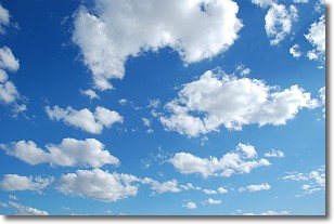
Weather Topic: What are Cumulonimbus Clouds?
Home - Education - Cloud Types - Cumulonimbus Clouds
 Next Topic: Cumulus Clouds
The final form taken by a growing cumulus cloud is the
cumulonimbus cloud, which is very tall and dense.
The tower of a cumulonimbus cloud can soar 23 km into the atmosphere, although
most commonly they stop growing at an altitude of 6 km.
Even small cumulonimbus clouds appear very large in comparison to other cloud types.
They can signal the approach of stormy weather, such as thunderstorms or blizzards.
Next Topic: Cumulus Clouds
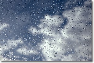
Weather Topic: What is Drizzle?
Home - Education - Precipitation - Drizzle
 Next Topic: Evaporation
Drizzle is precipitation in the form of water droplets which are
smaller than raindrops.
Drizzle is characterized by fine, gently falling droplets and typically does not
impact human habitation in a negative way. The exception to this is freezing drizzle,
a condition where drizzle freezes immediately upon reaching earth's surface.
Freezing drizzle is still less dangerous than freezing rain, but can
potentially result in hazardous road conditions.
Next Topic: Evaporation
Current conditions powered by WeatherAPI.com


