Weather Alert in Washington
Flood Warning issued March 14 at 1:16PM PDT until March 15 at 6:00AM PDT by NWS Portland OR
AREAS AFFECTED: Cowlitz, WA
DESCRIPTION: ...The Flood Warning continues for the following rivers in Washington... Cowlitz River at Kelso affecting Cowlitz County. ...The Flood Warning is cancelled for the following rivers in Washington...Oregon... Cowlitz River at Castle Rock affecting Cowlitz County. Wilson River near Tillamook affecting Tillamook County. * WHAT...Minor flooding is occurring and minor flooding is forecast. * WHERE...Cowlitz River at Kelso. * WHEN...Until tomorrow morning. * IMPACTS...Above 21.5 feet, flooding of several low lying and secondary roads begins, including the Cowlitz Gardens neighborhood, along with flooding of pasture and lowland upstream of Kelso. * ADDITIONAL DETAILS... - At 12:58 PM PDT Saturday the stage was 22.4 feet. - Bankfull stage is 18.0 feet. - Recent Activity...The maximum river stage in the 24 hours ending at 12:58 PM PDT Saturday was 23.5 feet. - Forecast...The river will oscillate above flood stage with a maximum value of 22.3 feet this afternoon. It will fall below flood stage late this evening. - Flood stage is 21.5 feet. - http://www.weather.gov/safety/flood
INSTRUCTION: Be especially cautious at night when it is harder to recognize the dangers of flooding. Motorists should not attempt to drive around barricades or drive through flooded areas. Turn around, don't drown when encountering flooded roads. Most flood deaths occur in vehicles. Additional information is available at www.weather.gov. The next statement will be issued this afternoon at 230 PM PDT.
Want more detail? Get the Complete 7 Day and Night Detailed Forecast!
Current U.S. National Radar--Current
The Current National Weather Radar is shown below with a UTC Time (subtract 5 hours from UTC to get Eastern Time).

National Weather Forecast--Current
The Current National Weather Forecast and National Weather Map are shown below.

National Weather Forecast for Tomorrow
Tomorrow National Weather Forecast and Tomorrow National Weather Map are show below.

North America Water Vapor (Moisture)
This map shows recent moisture content over North America. Bright and colored areas show high moisture (ie, clouds); brown indicates very little moisture present; black indicates no moisture.

Weather Topic: What is Drizzle?
Home - Education - Precipitation - Drizzle
 Next Topic: Evaporation
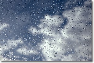
Drizzle is precipitation in the form of water droplets which are
smaller than raindrops.
Drizzle is characterized by fine, gently falling droplets and typically does not
impact human habitation in a negative way. The exception to this is freezing drizzle,
a condition where drizzle freezes immediately upon reaching earth's surface.
Freezing drizzle is still less dangerous than freezing rain, but can
potentially result in hazardous road conditions.
Next Topic: Evaporation
Weather Topic: What is Fog?
Home - Education - Cloud Types - Fog
 Next Topic: Fractus Clouds
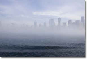
Fog is technically a type of stratus cloud, which lies along the
ground and obscures visibility.
It is usually created when humidity in the air condenses into tiny water droplets.
Because of this, some places are more prone to foggy weather, such as regions
close to a body of water.
Fog is similar to mist; both are the appearance of water droplets suspended in
the air, but fog is the term applied to the condition when visibility is less than 1 km.
Next Topic: Fractus Clouds
Current conditions powered by WeatherAPI.com


