Weather Alert in Wisconsin
Special Weather Statement issued August 22 at 2:37PM CDT by NWS Green Bay WI
AREAS AFFECTED: Vilas; Oneida
DESCRIPTION: At 236 PM CDT, Doppler radar was tracking strong thunderstorms along a line extending from 9 miles southeast of Gile to 6 miles west of Turtle Flambeau Flowage to 12 miles northwest of Phillips. Movement was east at 30 mph. HAZARD...Wind gusts up to 40 mph and pea size hail. SOURCE...Radar indicated. IMPACT...Gusty winds could knock down tree limbs and blow around unsecured objects. Minor hail damage to vegetation is possible. Strong thunderstorms will be near... Winchester around 255 PM CDT. Lac Du Flambeau and Rice Creek Natural Area around 315 PM CDT. Border Lakes Natural Area around 320 PM CDT. Other locations impacted by these storms include Sayner, Nixon Lake Natural Area, Hazelhurst, Woodruff, Tomahawk River Pines Natural Area, High Lake Natural Area, Arbor Vitae, Van Vliet Hemlocks Natural Area, Trout Lake, and Manitowish Waters.
INSTRUCTION: If outdoors, consider seeking shelter inside a building.
Want more detail? Get the Complete 7 Day and Night Detailed Forecast!
Current U.S. National Radar--Current
The Current National Weather Radar is shown below with a UTC Time (subtract 5 hours from UTC to get Eastern Time).

National Weather Forecast--Current
The Current National Weather Forecast and National Weather Map are shown below.

National Weather Forecast for Tomorrow
Tomorrow National Weather Forecast and Tomorrow National Weather Map are show below.

North America Water Vapor (Moisture)
This map shows recent moisture content over North America. Bright and colored areas show high moisture (ie, clouds); brown indicates very little moisture present; black indicates no moisture.

Weather Topic: What are Altocumulus Clouds?
Home - Education - Cloud Types - Altocumulus Clouds
 Next Topic: Altostratus Clouds
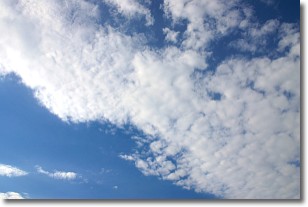
Similar to cirrocumulus clouds, altocumulus clouds are
characterized by cloud patches. They are distinguished by larger cloudlets
than cirrocumulus clouds but are still smaller than stratocumulus clouds.
Altocumulus clouds most commonly form in middle altitudes (between 2 and 5 km)
and may resemble, at times, the shape of a flying saucer.
These uncommon formations, called altocumulus lenticularis, are created by uplift
in the atmosphere and are most often seen in close proximity to mountains.
Next Topic: Altostratus Clouds
Weather Topic: What are Cirrocumulus Clouds?
Home - Education - Cloud Types - Cirrocumulus Clouds
 Next Topic: Cirrostratus Clouds
Cirrocumulus clouds form at high altitudes (usually around 5 km)
and have distinguishing characteristics displayed in a fine layer of
small cloud patches. These small cloud patches are sometimes referred to as
"cloudlets" in relation to the whole cloud formation.
Cirrocumulus clouds are formed from ice crystals and water droplets. Often, the
water droplets in the cloud freeze into ice crystals and the cloud becomes a
cirrostratus cloud. Because of this common occurrence, cirrocumulus cloud
formations generally pass rapidly.
Next Topic: Cirrostratus Clouds
Current conditions powered by WeatherAPI.com


