Weather Alert in South Dakota
Flood Warning issued August 22 at 9:18PM CDT by NWS Aberdeen SD
AREAS AFFECTED: Codington, SD
DESCRIPTION: ...The Flood Warning is extended for the following rivers in South Dakota... Big Sioux River at Watertown Broadway Avenue affecting Codington County. Big Sioux River Near Castlewood affecting Hamlin County. ...The Flood Warning continues for the following rivers in South Dakota... Big Sioux River Below Watertown affecting Codington County. .For sites with a river forecast, the forecast includes precipitation through the next 24 hours. Any future precipitation could affect the forecasts. * WHAT...Moderate flooding is occurring. * WHERE...Big Sioux River below Watertown. * WHEN...Until further notice. * IMPACTS...At 11.7 feet, Water goes over the low spot on the road 300 feet east of the gauging location * ADDITIONAL DETAILS... - At 8:45 PM CDT Friday the stage was 11.7 feet. - Recent Activity...The maximum river stage in the 24 hours ending at 8:45 PM CDT Friday was 11.7 feet. - Flood stage is 11.0 feet. - http://www.weather.gov/safety/flood
INSTRUCTION: Turn around, don't drown when encountering flooded roads. Most flood deaths occur in vehicles. Additional information is available at www.weather.gov/abr. The next statement will be issued by Sunday morning at 700 AM CDT.
Want more detail? Get the Complete 7 Day and Night Detailed Forecast!
Current U.S. National Radar--Current
The Current National Weather Radar is shown below with a UTC Time (subtract 5 hours from UTC to get Eastern Time).

National Weather Forecast--Current
The Current National Weather Forecast and National Weather Map are shown below.

National Weather Forecast for Tomorrow
Tomorrow National Weather Forecast and Tomorrow National Weather Map are show below.

North America Water Vapor (Moisture)
This map shows recent moisture content over North America. Bright and colored areas show high moisture (ie, clouds); brown indicates very little moisture present; black indicates no moisture.

Weather Topic: What are Cumulonimbus Clouds?
Home - Education - Cloud Types - Cumulonimbus Clouds
 Next Topic: Cumulus Clouds
The final form taken by a growing cumulus cloud is the
cumulonimbus cloud, which is very tall and dense.
The tower of a cumulonimbus cloud can soar 23 km into the atmosphere, although
most commonly they stop growing at an altitude of 6 km.
Even small cumulonimbus clouds appear very large in comparison to other cloud types.
They can signal the approach of stormy weather, such as thunderstorms or blizzards.
Next Topic: Cumulus Clouds
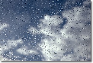
Weather Topic: What is Drizzle?
Home - Education - Precipitation - Drizzle
 Next Topic: Evaporation
Drizzle is precipitation in the form of water droplets which are
smaller than raindrops.
Drizzle is characterized by fine, gently falling droplets and typically does not
impact human habitation in a negative way. The exception to this is freezing drizzle,
a condition where drizzle freezes immediately upon reaching earth's surface.
Freezing drizzle is still less dangerous than freezing rain, but can
potentially result in hazardous road conditions.
Next Topic: Evaporation
Current conditions powered by WeatherAPI.com


