Weather Alert in Ohio
Flood Warning issued March 14 at 9:27PM EDT by NWS Northern Indiana
AREAS AFFECTED: Defiance, OH; Fulton, OH; Williams, OH
DESCRIPTION: ...The Flood Warning continues for the following rivers in Ohio... Indiana... Saint Joseph River Ohio near Newville affecting Defiance, Allen IN and De Kalb Counties. Saint Joseph River Ohio below Montpelier affecting Williams County. Tiffin River at Stryker affecting Defiance, Fulton OH and Williams Counties. ...The Flood Warning is extended for the following rivers in Indiana... North Branch Elkhart River at Cosperville affecting Noble County. .Rises on area rivers occurred as a result of recent heavy rainfall from severe thunderstorms. Three of these locations aside from Cosperville have crested and are receding. For the Saint Joseph River Ohio...including Montpelier, Newville... Moderate flooding is forecast. For the Tiffin River...including Stryker...Minor flooding is forecast. For the Elkhart River...including Cosperville...Minor flooding is forecast. * WHAT...Minor flooding is occurring and minor flooding is forecast. * WHERE...Tiffin River at Stryker. * WHEN...Until further notice. * IMPACTS...At 13.0 feet, Flood waters begin to affect some farm buildings near Stryker and flood some secondary roads. * ADDITIONAL DETAILS... - At 9:00 PM EDT Saturday the stage was 13.9 feet. - Recent Activity...The maximum river stage in the 24 hours ending at 9:00 PM EDT Saturday was 15.2 feet. - Forecast...The river is expected to fall to 11.3 feet Thursday evening. - Flood stage is 11.0 feet. - http://www.weather.gov/safety/flood
INSTRUCTION: Turn around, don't drown when encountering flooded roads. Most flood deaths occur in vehicles. Detailed river forecasts and additional information can be found at www.weather.gov/iwx under Rivers and Lakes. The next statement will be issued Sunday afternoon at 330 PM EDT.
Want more detail? Get the Complete 7 Day and Night Detailed Forecast!
Current U.S. National Radar--Current
The Current National Weather Radar is shown below with a UTC Time (subtract 5 hours from UTC to get Eastern Time).

National Weather Forecast--Current
The Current National Weather Forecast and National Weather Map are shown below.

National Weather Forecast for Tomorrow
Tomorrow National Weather Forecast and Tomorrow National Weather Map are show below.

North America Water Vapor (Moisture)
This map shows recent moisture content over North America. Bright and colored areas show high moisture (ie, clouds); brown indicates very little moisture present; black indicates no moisture.

Weather Topic: What are Cumulonimbus Clouds?
Home - Education - Cloud Types - Cumulonimbus Clouds
 Next Topic: Cumulus Clouds
The final form taken by a growing cumulus cloud is the
cumulonimbus cloud, which is very tall and dense.
The tower of a cumulonimbus cloud can soar 23 km into the atmosphere, although
most commonly they stop growing at an altitude of 6 km.
Even small cumulonimbus clouds appear very large in comparison to other cloud types.
They can signal the approach of stormy weather, such as thunderstorms or blizzards.
Next Topic: Cumulus Clouds
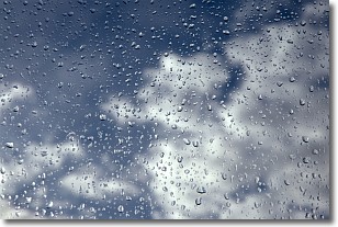
Weather Topic: What is Drizzle?
Home - Education - Precipitation - Drizzle
 Next Topic: Evaporation
Drizzle is precipitation in the form of water droplets which are
smaller than raindrops.
Drizzle is characterized by fine, gently falling droplets and typically does not
impact human habitation in a negative way. The exception to this is freezing drizzle,
a condition where drizzle freezes immediately upon reaching earth's surface.
Freezing drizzle is still less dangerous than freezing rain, but can
potentially result in hazardous road conditions.
Next Topic: Evaporation
Current conditions powered by WeatherAPI.com


