Weather Alert in Nevada
Hydrologic Outlook issued August 22 at 11:29PM PDT by NWS Elko NV
AREAS AFFECTED: Elko, NV; Eureka, NV
DESCRIPTION: ESFLKN Deep, monsoonal moisture will surge northward into most of Northern and Central Nevada Sunday afternoon through Wednesday evening. As a result, showers and thunderstorms will develop across much of Northern and Central Nevada each afternoon and evening Sunday through Wednesday. Slow storm motions may result in heavy rainfall and localized flooding. Of great concern will be recent, large burn scars left from the following incidents: the Snowstorm Complex near Midas, the Cottonwood Peak fire north of Tuscarora, the Hot Canyon fire northwest of Montello, and the Adobe fire north of Elko. Numerous other smaller burn scars have been created this past fire season and are also of concern. If living near recently burned areas, please have a way to receive flash flood warnings and be prepared to take action should warnings be issued. If you are traveling or recreating in areas that have burn scars, please consider changing plans.
INSTRUCTION: N/A
Want more detail? Get the Complete 7 Day and Night Detailed Forecast!
Current U.S. National Radar--Current
The Current National Weather Radar is shown below with a UTC Time (subtract 5 hours from UTC to get Eastern Time).

National Weather Forecast--Current
The Current National Weather Forecast and National Weather Map are shown below.

National Weather Forecast for Tomorrow
Tomorrow National Weather Forecast and Tomorrow National Weather Map are show below.

North America Water Vapor (Moisture)
This map shows recent moisture content over North America. Bright and colored areas show high moisture (ie, clouds); brown indicates very little moisture present; black indicates no moisture.

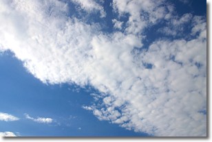
Weather Topic: What are Altocumulus Clouds?
Home - Education - Cloud Types - Altocumulus Clouds
 Next Topic: Altostratus Clouds
Similar to cirrocumulus clouds, altocumulus clouds are
characterized by cloud patches. They are distinguished by larger cloudlets
than cirrocumulus clouds but are still smaller than stratocumulus clouds.
Altocumulus clouds most commonly form in middle altitudes (between 2 and 5 km)
and may resemble, at times, the shape of a flying saucer.
These uncommon formations, called altocumulus lenticularis, are created by uplift
in the atmosphere and are most often seen in close proximity to mountains.
Next Topic: Altostratus Clouds
Weather Topic: What are Cirrocumulus Clouds?
Home - Education - Cloud Types - Cirrocumulus Clouds
 Next Topic: Cirrostratus Clouds
Cirrocumulus clouds form at high altitudes (usually around 5 km)
and have distinguishing characteristics displayed in a fine layer of
small cloud patches. These small cloud patches are sometimes referred to as
"cloudlets" in relation to the whole cloud formation.
Cirrocumulus clouds are formed from ice crystals and water droplets. Often, the
water droplets in the cloud freeze into ice crystals and the cloud becomes a
cirrostratus cloud. Because of this common occurrence, cirrocumulus cloud
formations generally pass rapidly.
Next Topic: Cirrostratus Clouds
Current conditions powered by WeatherAPI.com


