Weather Alert in Oregon
Flood Advisory issued March 14 at 1:48PM PDT until March 15 at 12:00PM PDT by NWS Pendleton OR
AREAS AFFECTED: Umatilla, OR; Union, OR; Wallowa, OR; Columbia, WA; Walla Walla, WA
DESCRIPTION: * WHAT...Flooding caused by runoff and snowmelt continues. * WHERE...Portions of northeast Oregon, including the following counties, Umatilla, Union and Wallowa and southeast Washington, including the following counties, Columbia and Walla Walla. * WHEN...Until noon PDT Sunday. * IMPACTS...Minor flooding in low-lying and poor drainage areas. Rises in small streams and normally dry arroyos. Overflowing poor drainage areas. River or stream flows are elevated. * ADDITIONAL DETAILS... - At 145 PM PDT, emergency management reported river flooding along area rivers and streams. Minor flooding is ongoing or is imminent. - Area rivers and streams is the most likely place to experience minor flooding. Flooding impacts will continue, but no additional rainfall is expected. - Some locations that will experience flooding include... Walla Walla, Pendleton, La Grande, Dayton, Meacham, College Place, Milton-Freewater, Waitsburg, Athena, Weston, Adams, Prescott, Helix, Starbuck, Bingham Springs, Tollgate, Spout Springs, Garrett, Gibbon and Dixie. - http://www.weather.gov/safety/flood
INSTRUCTION: Turn around, don't drown when encountering flooded roads. Most flood deaths occur in vehicles. Be aware of your surroundings and do not drive on flooded roads. In hilly terrain there are hundreds of low water crossings which are potentially dangerous in heavy rain. Do not attempt to cross flooded roads. Find an alternate route.
Want more detail? Get the Complete 7 Day and Night Detailed Forecast!
Current U.S. National Radar--Current
The Current National Weather Radar is shown below with a UTC Time (subtract 5 hours from UTC to get Eastern Time).

National Weather Forecast--Current
The Current National Weather Forecast and National Weather Map are shown below.

National Weather Forecast for Tomorrow
Tomorrow National Weather Forecast and Tomorrow National Weather Map are show below.

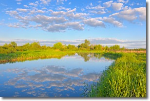
North America Water Vapor (Moisture)
This map shows recent moisture content over North America. Bright and colored areas show high moisture (ie, clouds); brown indicates very little moisture present; black indicates no moisture.

Weather Topic: What are Stratocumulus Clouds?
Home - Education - Cloud Types - Stratocumulus Clouds
 Next Topic: Stratus Clouds
Stratocumulus clouds are similar to altocumulus clouds in their
fluffy appearance, but have a slightly darker shade due to their additional mass.
A good way to distinguish the two cloud types is to hold your hand out and measure
the size of an individual cloud; if it is the size of your thumb it is generally
an altocumulus cloud, if it is the size of your hand it is generally a
stratocumulus cloud.
It is uncommon for stratocumulus clouds to produce precipitation, but if they do
it is usually a light rain or snow.
Next Topic: Stratus Clouds
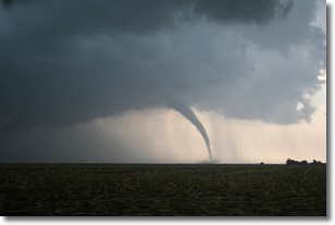
Weather Topic: What are Wall Clouds?
Home - Education - Cloud Types - Wall Clouds
 Next Topic: Altocumulus Clouds
A wall cloud forms underneath the base of a cumulonimbus cloud,
and can be a hotbed for deadly tornadoes.
Wall clouds are formed by air flowing into the cumulonimbus clouds, which can
result in the wall cloud descending from the base of the cumulonimbus cloud, or
rising fractus clouds which join to the base of the storm cloud as the wall cloud
takes shape.
Wall clouds can be very large, and in the Northern Hemisphere they generally
form at the southern edge of cumulonimbus clouds.
Next Topic: Altocumulus Clouds
Current conditions powered by WeatherAPI.com


