Weather Alert in Alaska
Flood Advisory issued September 4 at 12:36PM AKDT until September 6 at 12:00PM AKDT by NWS Fairbanks AK
AREAS AFFECTED: Upper Koyukuk Valley
DESCRIPTION: * WHAT...Flooding caused by excessive rainfall continues. * WHERE...Koyukuk River near Allakaket. * WHEN...Until noon AKDT Saturday. * IMPACTS...Minor flooding in low-lying and poorly drained areas. * ADDITIONAL DETAILS... - For the duration of this event there have been reports of some low lying roads being inundated. - The streamgage on the Koyukuk River below the John River shows water levels have been fluctuating less that a foot over the last 5 days and are not showing a rising or dropping trend. Though rain is still falling in areas on the south side of the Brooks Range, upstream locations (Slate Creek and the Middle and South Forks of the Koyukuk River) are not showing significant increases in response. Water levels are expected to remain steady at Allakaket for the next few days. - Http://www.weather.gov/aprfc
INSTRUCTION: N/A
Want more detail? Get the Complete 7 Day and Night Detailed Forecast!
Current U.S. National Radar--Current
The Current National Weather Radar is shown below with a UTC Time (subtract 5 hours from UTC to get Eastern Time).

National Weather Forecast--Current
The Current National Weather Forecast and National Weather Map are shown below.

National Weather Forecast for Tomorrow
Tomorrow National Weather Forecast and Tomorrow National Weather Map are show below.

North America Water Vapor (Moisture)
This map shows recent moisture content over North America. Bright and colored areas show high moisture (ie, clouds); brown indicates very little moisture present; black indicates no moisture.

Weather Topic: What is Rain?
Home - Education - Precipitation - Rain
 Next Topic: Shelf Clouds
Precipitation in the form of water droplets is called rain.
Rain generally has a tendency to fall with less intensity over a greater period
of time, and when rainfall is more severe it is usually less sustained.
Rain is the most common form of precipitation and happens with greater frequency
depending on the season and regional influences. Cities have been shown to have
an observable effect on rainfall, due to an effect called the urban heat island.
Compared to upwind, monthly rainfall between twenty and forty miles downwind of
cities is 30% greater.
Next Topic: Shelf Clouds
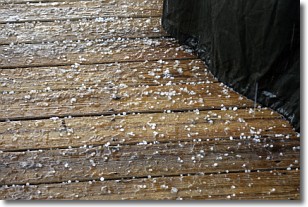
Weather Topic: What is Sleet?
Home - Education - Precipitation - Sleet
 Next Topic: Snow
Sleet is a form of precipitation in which small ice pellets are the primary
components. These ice pellets are smaller and more translucent than hailstones,
and harder than graupel. Sleet is caused by specific atmospheric conditions and
therefore typically doesn't last for extended periods of time.
The condition which leads to sleet formation requires a warmer body of air to be
wedged in between two sub-freezing bodies of air. When snow falls through a warmer
layer of air it melts, and as it falls through the next sub-freezing body of air
it freezes again, forming ice pellets known as sleet. In some cases, water
droplets don't have time to freeze before reaching the surface and the result is
freezing rain.
Next Topic: Snow
Current conditions powered by WeatherAPI.com


