Weather Alert in California
Extreme Heat Watch issued March 15 at 12:20AM PDT until March 20 at 8:00PM PDT by NWS Las Vegas NV
AREAS AFFECTED: Death Valley National Park; Western Mojave Desert; Eastern Mojave Desert, Including the Mojave National Preserve; Morongo Basin; Cadiz Basin
DESCRIPTION: * WHAT...High temperatures in the Colorado River Valley and the lower elevations of Death Valley will top out in the 100 to 108 range. Temperatures in the lower elevations of San Bernardino County will top out in the 95 to 105 range with temperatures in the higher elevations topping out in the 90s. * WHERE...Cadiz Basin, Death Valley National Park, Eastern Mojave Desert, Morongo Basin, and Western Mojave Desert. * WHEN...From Wednesday morning through Friday evening. * IMPACTS...Heat related illnesses increase significantly during extreme heat events.
INSTRUCTION: Drink plenty of fluids, stay in an air-conditioned room, stay out of the sun, and check up on relatives and neighbors. Do not leave young children and pets in unattended vehicles. Car interiors will reach lethal temperatures in a matter of minutes. Monitor the latest forecasts and warnings for updates.
Want more detail? Get the Complete 7 Day and Night Detailed Forecast!
Current U.S. National Radar--Current
The Current National Weather Radar is shown below with a UTC Time (subtract 5 hours from UTC to get Eastern Time).

National Weather Forecast--Current
The Current National Weather Forecast and National Weather Map are shown below.

National Weather Forecast for Tomorrow
Tomorrow National Weather Forecast and Tomorrow National Weather Map are show below.

North America Water Vapor (Moisture)
This map shows recent moisture content over North America. Bright and colored areas show high moisture (ie, clouds); brown indicates very little moisture present; black indicates no moisture.

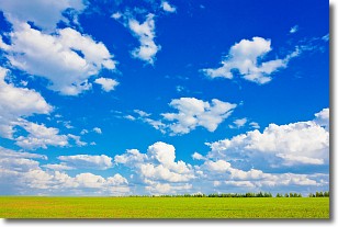
Weather Topic: What are Cumulus Clouds?
Home - Education - Cloud Types - Cumulus Clouds
 Next Topic: Drizzle
Cumulus clouds are fluffy and textured with rounded tops, and
may have flat bottoms. The border of a cumulus cloud
is clearly defined, and can have the appearance of cotton or cauliflower.
Cumulus clouds form at low altitudes (rarely above 2 km) but can grow very tall,
becoming cumulus congestus and possibly the even taller cumulonimbus clouds.
When cumulus clouds become taller, they have a greater chance of producing precipitation.
Next Topic: Drizzle
Weather Topic: What is Evaporation?
Home - Education - Precipitation - Evaporation
 Next Topic: Fog
Evaporation is the process which returns water from the earth
back to the atmosphere, and is another crucial process in the water cycle.
Evaporation is the transformation of liquid into gas, and it happens because
molecules are excited by the application of energy and turn into vapor.
In order for water to evaporate it has to be on the surface of a body of water.
Next Topic: Fog
Current conditions powered by WeatherAPI.com


