Weather Alert in Texas
Fire Weather Watch issued March 14 at 9:49PM CDT until March 16 at 7:00PM CDT by NWS Corpus Christi TX
AREAS AFFECTED: La Salle; McMullen; Live Oak; Bee; Goliad; Victoria; Webb; Duval; Jim Wells; Inland Kleberg; Inland Nueces; Inland San Patricio; Coastal Aransas; Inland Refugio; Inland Calhoun; Coastal Kleberg; Coastal Nueces; Coastal San Patricio; Coastal Refugio; Coastal Calhoun
DESCRIPTION: ...Critical Fire Weather Conditions Sunday Night into Monday... A strong cold will push through Sunday night ushering in drier and colder air. Relative humidity values Monday are expected to drop into the 10-20% range with strong winds around 20-25 mph. * AFFECTED AREA...La Salle, McMullen, Live Oak, Bee, Goliad, Victoria, Webb, Duval, Jim Wells, Inland Kleberg, Inland Nueces, Inland San Patricio, Coastal Aransas, Inland Refugio, Inland Calhoun, Coastal Kleberg, Coastal Nueces, Coastal San Patricio, Coastal Refugio and Coastal Calhoun. * TIMING...From 10 PM Sunday to 7 PM Monday evening * WINDS...North 20 to 30 mph with gusts up to 45 mph. * RELATIVE HUMIDITY...As low as 10 percent. * TEMPERATURES...Up to 76. * IMPACTS...Any fires that develop will likely spread rapidly. Outdoor burning is not recommended
INSTRUCTION: A Fire Weather Watch means that critical fire weather conditions are forecast to occur. Listen for later forecasts and possible Red Flag Warnings.
Want more detail? Get the Complete 7 Day and Night Detailed Forecast!
Current U.S. National Radar--Current
The Current National Weather Radar is shown below with a UTC Time (subtract 5 hours from UTC to get Eastern Time).

National Weather Forecast--Current
The Current National Weather Forecast and National Weather Map are shown below.

National Weather Forecast for Tomorrow
Tomorrow National Weather Forecast and Tomorrow National Weather Map are show below.

North America Water Vapor (Moisture)
This map shows recent moisture content over North America. Bright and colored areas show high moisture (ie, clouds); brown indicates very little moisture present; black indicates no moisture.

Weather Topic: What are Nimbostratus Clouds?
Home - Education - Cloud Types - Nimbostratus Clouds
 Next Topic: Precipitation
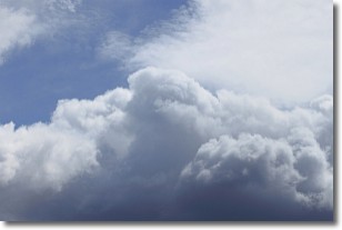
A nimbostratus cloud is similar to a stratus cloud in its formless,
smooth appearance. However, a nimbostratus cloud is darker than a stratus cloud,
because it is thicker.
Unlike a stratus cloud, a nimbostratus cloud typically brings with it the threat
of moderate to heavy precipitation. In some cases, the precipitation may evaporate
before reaching the ground, a phenomenon known as virga.
Next Topic: Precipitation
Weather Topic: What is Rain?
Home - Education - Precipitation - Rain
 Next Topic: Shelf Clouds
Precipitation in the form of water droplets is called rain.
Rain generally has a tendency to fall with less intensity over a greater period
of time, and when rainfall is more severe it is usually less sustained.
Rain is the most common form of precipitation and happens with greater frequency
depending on the season and regional influences. Cities have been shown to have
an observable effect on rainfall, due to an effect called the urban heat island.
Compared to upwind, monthly rainfall between twenty and forty miles downwind of
cities is 30% greater.
Next Topic: Shelf Clouds
Current conditions powered by WeatherAPI.com


