Weather Alert in Washington
Hydrologic Outlook issued August 14 at 12:20PM PDT by NWS Seattle WA
AREAS AFFECTED: Clallam, WA; Grays Harbor, WA; Island, WA; Jefferson, WA; King, WA; Kitsap, WA; Lewis, WA; Mason, WA; Pierce, WA; San Juan, WA; Skagit, WA; Snohomish, WA; Thurston, WA; Whatcom, WA
DESCRIPTION: ESFSEW A frontal system will move across the area Friday into Saturday across western Washington. Through Saturday afternoon, 3-5 inches of rain are expected across the mountains, with 0.5-1.5 inches expected through the lowlands. Very dry antecedent conditions has left the area soils dry and hard. This amount of rainfall in one storm will not have much time to soak into the very dry soil, which will result in heavy surface runoff. Impacts are uncertain due to how much moisture will be able to be absorbed by the soil. Several different threats are expected with this storm, which are detailed below. *Urban and urban-like flooding will be possible in flat areas and roadways. *Some small streams and creeks may become swollen due to rapid runoff while others may remain lower if the channel bed is able to absorb the water efficiently. *Rivers will not flood, but will undergo rapid rises to unusually high levels for this time of year, some of which may reach daily record crests. This will pose a threat to those engaged in recreational activities in and along river channels. *Burn scars will have the potential to undergo impacts, but the probability is low. Impacts may include flash flooding, debris flows, rock falls, and other falling debris. *Those engaging in recreational activities in the mountains may face challenges to where high water may make forest roads and trails difficult to traverse. Please monitor the latest forecasts from the National Weather Service for additional information.
INSTRUCTION: N/A
Want more detail? Get the Complete 7 Day and Night Detailed Forecast!
Current U.S. National Radar--Current
The Current National Weather Radar is shown below with a UTC Time (subtract 5 hours from UTC to get Eastern Time).

National Weather Forecast--Current
The Current National Weather Forecast and National Weather Map are shown below.

National Weather Forecast for Tomorrow
Tomorrow National Weather Forecast and Tomorrow National Weather Map are show below.

North America Water Vapor (Moisture)
This map shows recent moisture content over North America. Bright and colored areas show high moisture (ie, clouds); brown indicates very little moisture present; black indicates no moisture.

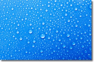
Weather Topic: What is Condensation?
Home - Education - Precipitation - Condensation
 Next Topic: Contrails
Condensation is the process which creates clouds, and therefore
it is a crucial process in the water cycle.
Condensation is the change of matter from a state of gas into a state of liquid,
and it happens because water molecules release heat into the atmosphere and
become organized into a more closely packed structure, what we might see as
water droplets.
Water is always present in the air around us as a vapor, but it's too small for
us to see. When water undergoes the process of condensation it becomes organized
into visible water droplets. You've probably seen condensation happen before on the
surface of a cold drink!
Next Topic: Contrails
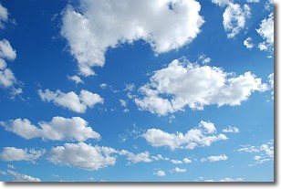
Weather Topic: What are Cumulonimbus Clouds?
Home - Education - Cloud Types - Cumulonimbus Clouds
 Next Topic: Cumulus Clouds
The final form taken by a growing cumulus cloud is the
cumulonimbus cloud, which is very tall and dense.
The tower of a cumulonimbus cloud can soar 23 km into the atmosphere, although
most commonly they stop growing at an altitude of 6 km.
Even small cumulonimbus clouds appear very large in comparison to other cloud types.
They can signal the approach of stormy weather, such as thunderstorms or blizzards.
Next Topic: Cumulus Clouds
Current conditions powered by WeatherAPI.com


