Weather Alert in Texas
Red Flag Warning issued March 14 at 12:00PM CDT until March 16 at 8:00PM CDT by NWS Austin/San Antonio TX
AREAS AFFECTED: Llano; Burnet; Williamson; Val Verde; Edwards; Real; Kerr; Bandera; Gillespie; Kendall; Blanco; Hays; Travis; Bastrop; Lee; Kinney; Uvalde; Medina; Bexar; Comal; Guadalupe; Caldwell; Fayette; Maverick; Zavala; Frio; Atascosa; Wilson; Karnes; Gonzales; De Witt; Lavaca; Dimmit
DESCRIPTION: ...CRITICAL FIRE WEATHER CONDITIONS SUNDAY THROUGH MONDAY... .Strong to very strong winds and dry air associated with both a dryline and cold front will result in a prolonged period of critical fire weather conditions across South-Central Texas on Sunday through Monday. The National Weather Service in Austin/San Antonio has issued a Red Flag Warning for wind and low relative humidity, which is in effect from Sunday afternoon through Monday evening. The Fire Weather Watch is no longer in effect. * AFFECTED AREA...All of South-Central Texas. * TIMING...From Sunday afternoon through Monday evening. * WINDS...West 10 to 20 mph with gusts to 35 mph Sunday afternoon becoming North 20 to 35 mph with gusts of 45 to 55 mph Sunday evening into Sunday night. * RELATIVE HUMIDITY...10 to 25 percent Sunday and Monday afternoons. Poor overnight recovery during Sunday night with humidity rising only to near the 25 to 35 percent range. * IMPACTS...Any fire that develops will catch and spread rapidly. Outdoor burning is not recommended.
INSTRUCTION: A Red Flag Warning means that critical fire weather conditions are either occurring now....or will shortly. A combination of strong winds...low relative humidity...and warm temperatures can contribute to extreme fire behavior.
Want more detail? Get the Complete 7 Day and Night Detailed Forecast!
Current U.S. National Radar--Current
The Current National Weather Radar is shown below with a UTC Time (subtract 5 hours from UTC to get Eastern Time).

National Weather Forecast--Current
The Current National Weather Forecast and National Weather Map are shown below.

National Weather Forecast for Tomorrow
Tomorrow National Weather Forecast and Tomorrow National Weather Map are show below.

North America Water Vapor (Moisture)
This map shows recent moisture content over North America. Bright and colored areas show high moisture (ie, clouds); brown indicates very little moisture present; black indicates no moisture.

Weather Topic: What are Nimbostratus Clouds?
Home - Education - Cloud Types - Nimbostratus Clouds
 Next Topic: Precipitation
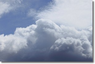
A nimbostratus cloud is similar to a stratus cloud in its formless,
smooth appearance. However, a nimbostratus cloud is darker than a stratus cloud,
because it is thicker.
Unlike a stratus cloud, a nimbostratus cloud typically brings with it the threat
of moderate to heavy precipitation. In some cases, the precipitation may evaporate
before reaching the ground, a phenomenon known as virga.
Next Topic: Precipitation
Weather Topic: What is Rain?
Home - Education - Precipitation - Rain
 Next Topic: Shelf Clouds
Precipitation in the form of water droplets is called rain.
Rain generally has a tendency to fall with less intensity over a greater period
of time, and when rainfall is more severe it is usually less sustained.
Rain is the most common form of precipitation and happens with greater frequency
depending on the season and regional influences. Cities have been shown to have
an observable effect on rainfall, due to an effect called the urban heat island.
Compared to upwind, monthly rainfall between twenty and forty miles downwind of
cities is 30% greater.
Next Topic: Shelf Clouds
Current conditions powered by WeatherAPI.com


