Weather Alert in Hawaii
Flash Flood Warning issued March 14 at 5:00PM HST until March 14 at 8:00PM HST by NWS Honolulu HI
AREAS AFFECTED: Maui, HI
DESCRIPTION: At 500 PM HST, radar indicated heavy rainfall over the island of Maui with stream levels continuing to increase. Rain was falling at a rate of 1.5 to 3 inches per hour with additional heavy rain expected to move in from the southwest. Emergency Management continues to report multiple roads closed due to flooding along with landslides and sinkholes. HAZARD...Heavy rain producing life threatening flash flooding. SOURCE...Radar and automated gauges. IMPACT...Significant and life threatening flooding in drainages, streams, rivers, roads, properties, and other low lying areas. Multiple public road closures expected, as well as landslides in steep terrain. Some locations that will experience flash flooding include... The entire island of Maui.
INSTRUCTION: Stay away from streams, rivers, drainage ditches, and culverts, even if they are currently dry. Do not cross fast flowing or rising water in your vehicle, or on foot. Turn around, don't drown. The heavy rains may cause rock and mudslides in steep terrain areas.
Want more detail? Get the Complete 7 Day and Night Detailed Forecast!
Current U.S. National Radar--Current
The Current National Weather Radar is shown below with a UTC Time (subtract 5 hours from UTC to get Eastern Time).

National Weather Forecast--Current
The Current National Weather Forecast and National Weather Map are shown below.

National Weather Forecast for Tomorrow
Tomorrow National Weather Forecast and Tomorrow National Weather Map are show below.

North America Water Vapor (Moisture)
This map shows recent moisture content over North America. Bright and colored areas show high moisture (ie, clouds); brown indicates very little moisture present; black indicates no moisture.

Weather Topic: What are Wall Clouds?
Home - Education - Cloud Types - Wall Clouds
 Next Topic: Altocumulus Clouds
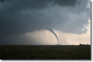
A wall cloud forms underneath the base of a cumulonimbus cloud,
and can be a hotbed for deadly tornadoes.
Wall clouds are formed by air flowing into the cumulonimbus clouds, which can
result in the wall cloud descending from the base of the cumulonimbus cloud, or
rising fractus clouds which join to the base of the storm cloud as the wall cloud
takes shape.
Wall clouds can be very large, and in the Northern Hemisphere they generally
form at the southern edge of cumulonimbus clouds.
Next Topic: Altocumulus Clouds
Weather Topic: What are Altostratus Clouds?
Home - Education - Cloud Types - Altostratus Clouds
 Next Topic: Cirrocumulus Clouds
Altostratus clouds form at mid to high-level altitudes
(between 2 and 7 km) and are created by a warm, stable air mass which causes
water vapor
to condense as it rise through the atmosphere. Usually altostratus clouds are
featureless sheets characterized by a uniform color.
In some cases, wind punching through the cloud formation may give it a waved
appearance, called altostratus undulatus. Altostratus clouds
are commonly seen with other cloud formations accompanying them.
Next Topic: Cirrocumulus Clouds
Current conditions powered by WeatherAPI.com


