Weather Alert in Washington
Flood Warning issued March 17 at 5:16AM PDT until March 22 at 11:00PM PDT by NWS Spokane WA
AREAS AFFECTED: Chelan, WA
DESCRIPTION: * WHAT...Flooding caused by rain and snowmelt is expected for the lower Stehekin Valley. * WHERE...A portion of North Central Washington, including the following county, Chelan. * WHEN...Until 1100 PM PDT Sunday. * IMPACTS...When the Stehekin River gauge hits 19.3 feet, water breaches the river bank. At 20 feet, water inundates some properties and overtops the temporary corduroy bridge. Company Creek Road begins to flood in places at the northern end and Battalion Creek culverts are beginning to be overtopped. At 20.5 feet, water begins to damage Wood Road. * ADDITIONAL DETAILS... - At 506 AM PDT, the Stehekin River is just under Action Stage (19.5 feet) at 19.4 feet, and is expected to rise to 19.5 feet in the next few hours. River levels will continue to rise through the week with an expected crest of 22.6 feet early Saturday morning. - http://www.weather.gov/safety/flood
INSTRUCTION: Those living in areas prone to flooding should be prepared to take action should flooding develop.
Want more detail? Get the Complete 7 Day and Night Detailed Forecast!
Current U.S. National Radar--Current
The Current National Weather Radar is shown below with a UTC Time (subtract 5 hours from UTC to get Eastern Time).

National Weather Forecast--Current
The Current National Weather Forecast and National Weather Map are shown below.

National Weather Forecast for Tomorrow
Tomorrow National Weather Forecast and Tomorrow National Weather Map are show below.

North America Water Vapor (Moisture)
This map shows recent moisture content over North America. Bright and colored areas show high moisture (ie, clouds); brown indicates very little moisture present; black indicates no moisture.

Weather Topic: What is Sleet?
Home - Education - Precipitation - Sleet
 Next Topic: Snow
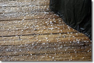
Sleet is a form of precipitation in which small ice pellets are the primary
components. These ice pellets are smaller and more translucent than hailstones,
and harder than graupel. Sleet is caused by specific atmospheric conditions and
therefore typically doesn't last for extended periods of time.
The condition which leads to sleet formation requires a warmer body of air to be
wedged in between two sub-freezing bodies of air. When snow falls through a warmer
layer of air it melts, and as it falls through the next sub-freezing body of air
it freezes again, forming ice pellets known as sleet. In some cases, water
droplets don't have time to freeze before reaching the surface and the result is
freezing rain.
Next Topic: Snow
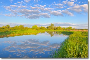
Weather Topic: What are Stratocumulus Clouds?
Home - Education - Cloud Types - Stratocumulus Clouds
 Next Topic: Stratus Clouds
Stratocumulus clouds are similar to altocumulus clouds in their
fluffy appearance, but have a slightly darker shade due to their additional mass.
A good way to distinguish the two cloud types is to hold your hand out and measure
the size of an individual cloud; if it is the size of your thumb it is generally
an altocumulus cloud, if it is the size of your hand it is generally a
stratocumulus cloud.
It is uncommon for stratocumulus clouds to produce precipitation, but if they do
it is usually a light rain or snow.
Next Topic: Stratus Clouds
Current conditions powered by WeatherAPI.com


