Weather Alert in Illinois
Flood Warning issued March 14 at 9:53PM EDT until March 22 at 5:00AM EDT by NWS Indianapolis IN
AREAS AFFECTED: Edwards, IL; Gallatin, IL; Wabash, IL; White, IL; Gibson, IN; Knox, IN; Posey, IN
DESCRIPTION: ...The Flood Warning continues for the following rivers in Indiana... Illinois... White River at Petersburg. White River at Edwardsport. White River at Hazleton. Wabash River at Mount Carmel. .Flooding will continue through early next week, with minor flooding of lowland areas persisting at Petersburg and Hazleton into early the following week. * WHAT...Minor flooding is occurring and minor flooding is forecast. * WHERE...Wabash River at Mount Carmel. * WHEN...Until Sunday, March 22. * IMPACTS...At 22.9 feet, Water begins to flow over River Road just north of Fifth Street in the Mount Carmel area. * ADDITIONAL DETAILS... - At 8:45 PM EDT Saturday /7:45 PM CDT Saturday/ the stage was 23.4 feet. - Recent Activity...The maximum river stage in the 24 hours ending at 8:45 PM EDT Saturday /7:45 PM CDT Saturday/ was 23.5 feet. - Forecast...The river is expected to fall below flood stage Saturday, March 21 and continue falling and remain below flood stage. - Flood stage is 19.0 feet. - http://www.weather.gov/safety/flood
INSTRUCTION: Caution is urged when walking near riverbanks. Motorists should not attempt to drive around barricades or drive cars through flooded areas. Additional information is available at www.weather.gov/ind. The next statement should be issued around 1100 AM Sunday.Sunday afternoon by around noon EDT /1100 AM CDT/.
Want more detail? Get the Complete 7 Day and Night Detailed Forecast!
Current U.S. National Radar--Current
The Current National Weather Radar is shown below with a UTC Time (subtract 5 hours from UTC to get Eastern Time).

National Weather Forecast--Current
The Current National Weather Forecast and National Weather Map are shown below.

National Weather Forecast for Tomorrow
Tomorrow National Weather Forecast and Tomorrow National Weather Map are show below.

North America Water Vapor (Moisture)
This map shows recent moisture content over North America. Bright and colored areas show high moisture (ie, clouds); brown indicates very little moisture present; black indicates no moisture.

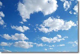
Weather Topic: What are Cumulonimbus Clouds?
Home - Education - Cloud Types - Cumulonimbus Clouds
 Next Topic: Cumulus Clouds
The final form taken by a growing cumulus cloud is the
cumulonimbus cloud, which is very tall and dense.
The tower of a cumulonimbus cloud can soar 23 km into the atmosphere, although
most commonly they stop growing at an altitude of 6 km.
Even small cumulonimbus clouds appear very large in comparison to other cloud types.
They can signal the approach of stormy weather, such as thunderstorms or blizzards.
Next Topic: Cumulus Clouds
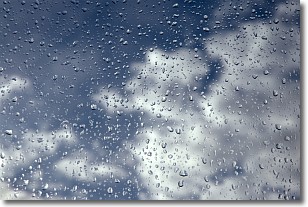
Weather Topic: What is Drizzle?
Home - Education - Precipitation - Drizzle
 Next Topic: Evaporation
Drizzle is precipitation in the form of water droplets which are
smaller than raindrops.
Drizzle is characterized by fine, gently falling droplets and typically does not
impact human habitation in a negative way. The exception to this is freezing drizzle,
a condition where drizzle freezes immediately upon reaching earth's surface.
Freezing drizzle is still less dangerous than freezing rain, but can
potentially result in hazardous road conditions.
Next Topic: Evaporation
Current conditions powered by WeatherAPI.com


