Weather Alert in Alaska
Winter Storm Warning issued March 14 at 2:38PM AKDT until March 16 at 1:00PM AKDT by NWS Juneau AK
AREAS AFFECTED: Cape Fairweather to Lisianski Strait
DESCRIPTION: ...MODERATE TO HEAVY SNOWFALL RETURNS SUNDAY INTO MONDAY... .Bands of snow showers are currently pushing into the NE Gulf as of Saturday afternoon with widely varying conditions. Advisory level snowfall rates of around 1 inch per 3 hours is expected from Yakutat to Sitka, with lighter rates inland. If snow showers train over one location for an extended period of time, visibility could drop to a half mile at times with greater accumulations. This wave of showers is separate from a stronger low pressure system that is expected to track northward across the panhandle starting Sunday morning and continuing through Monday. Steady snowfall will return with heaviest rates across the northern and central Alaska Panhandle starting Sunday morning and continuing into Monday. Current forecast snowfall accumulations within the Winter Storm Warnings are between 6 to 14 inches, with locally higher amounts expected through Monday evening. For southern panhandle communities in Winter Weather Advisories, expecting snowfall accumulations of 3 to 6 inches, highest totals within interior Prince of Wales Island. The main forecast challenge for the southern panhandle will be the timing and transition period to a rain and snow mix, or potentially all rain by Sunday afternoon with temperatures reaching into the upper 30s to low 40s along the coast as the front pushes northward, limiting potential snowfall accumulations. Snow showers will then continue behind this system with widely variable accumulations through the rest of the week. * WHAT...For the Winter Weather Advisory, snow. Additional snow accumulations of 2 to 4 inches. For the Winter Storm Warning, heavy snow expected. Total snow accumulations of 10 to 13 inches. Winds gusting as high as 40 mph. * WHERE...Cape Fairweather to Lisianski Strait. * WHEN...For the Winter Weather Advisory, until 5 AM AKDT Sunday. For the Winter Storm Warning, from 1 PM Sunday to 1 PM AKDT Monday. * IMPACTS...Travel will be very difficult and is discouraged unless it is an emergency. * ADDITIONAL DETAILS...Current forecast has heaviest snowfall rates arriving Sunday night into early Monday morning.
INSTRUCTION: Slow down and use caution while traveling. If you must travel, keep an extra flashlight, food, and water with you in case of an emergency. People are urged to prepare their property before the onset of winter weather. Mariners should prepare their vessels for heavy snow.
Want more detail? Get the Complete 7 Day and Night Detailed Forecast!
Current U.S. National Radar--Current
The Current National Weather Radar is shown below with a UTC Time (subtract 5 hours from UTC to get Eastern Time).

National Weather Forecast--Current
The Current National Weather Forecast and National Weather Map are shown below.

National Weather Forecast for Tomorrow
Tomorrow National Weather Forecast and Tomorrow National Weather Map are show below.

North America Water Vapor (Moisture)
This map shows recent moisture content over North America. Bright and colored areas show high moisture (ie, clouds); brown indicates very little moisture present; black indicates no moisture.

Weather Topic: What are Nimbostratus Clouds?
Home - Education - Cloud Types - Nimbostratus Clouds
 Next Topic: Precipitation
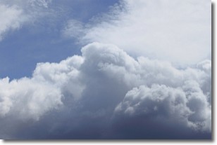
A nimbostratus cloud is similar to a stratus cloud in its formless,
smooth appearance. However, a nimbostratus cloud is darker than a stratus cloud,
because it is thicker.
Unlike a stratus cloud, a nimbostratus cloud typically brings with it the threat
of moderate to heavy precipitation. In some cases, the precipitation may evaporate
before reaching the ground, a phenomenon known as virga.
Next Topic: Precipitation
Weather Topic: What is Rain?
Home - Education - Precipitation - Rain
 Next Topic: Shelf Clouds
Precipitation in the form of water droplets is called rain.
Rain generally has a tendency to fall with less intensity over a greater period
of time, and when rainfall is more severe it is usually less sustained.
Rain is the most common form of precipitation and happens with greater frequency
depending on the season and regional influences. Cities have been shown to have
an observable effect on rainfall, due to an effect called the urban heat island.
Compared to upwind, monthly rainfall between twenty and forty miles downwind of
cities is 30% greater.
Next Topic: Shelf Clouds
Current conditions powered by WeatherAPI.com


