Weather Alert in New York
Coastal Flood Statement issued August 23 at 10:06AM EDT until August 23 at 11:00PM EDT by NWS Upton NY
AREAS AFFECTED: Southern Nassau
DESCRIPTION: * WHAT...For the High Rip Current Risk, dangerous rip currents. For the Coastal Flood Statement, up to one half foot of inundation above ground level expected in vulnerable areas near the waterfront and shoreline. * WHERE...Southern Nassau County. * WHEN...For the High Rip Current Risk, through Sunday evening. For the Coastal Flood Statement, from 7 PM EDT this evening through this evening. * IMPACTS...Brief minor flooding of the more vulnerable locations near the waterfront and shoreline. Life- threatening rip currents are likely for all people entering the surf zone. Anyone visiting the beaches should stay out of the surf. Rip currents can sweep even the best swimmers away from shore into deeper water. * COASTAL FLOOD IMPACTS...Minor flooding in the more vulnerable locations near the waterfront and shoreline. Some roads and low lying properties including parking lots, parks, lawns, and homes and businesses with basements near the waterfront will experience minor flooding. * SWIMMING IMPACTS...Life-threatening swimming and surfing conditions and localized beach erosion. Life-threatening rip currents are likely for all people entering the surf zone. Anyone visiting the beaches should stay out of the surf. Rip currents can sweep even the best swimmers away from shore into deeper water.
INSTRUCTION: Do not drive through flooded roadways. If you enter the surf zone, always have a flotation device with you and swim near a lifeguard. If caught in a rip current, relax and float, and do not swim against the current. If able, swim in a direction following the shoreline. If unable to escape, face the shore and yell or wave for help.
Want more detail? Get the Complete 7 Day and Night Detailed Forecast!
Current U.S. National Radar--Current
The Current National Weather Radar is shown below with a UTC Time (subtract 5 hours from UTC to get Eastern Time).

National Weather Forecast--Current
The Current National Weather Forecast and National Weather Map are shown below.

National Weather Forecast for Tomorrow
Tomorrow National Weather Forecast and Tomorrow National Weather Map are show below.

North America Water Vapor (Moisture)
This map shows recent moisture content over North America. Bright and colored areas show high moisture (ie, clouds); brown indicates very little moisture present; black indicates no moisture.

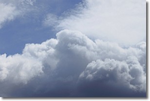
Weather Topic: What are Nimbostratus Clouds?
Home - Education - Cloud Types - Nimbostratus Clouds
 Next Topic: Precipitation
A nimbostratus cloud is similar to a stratus cloud in its formless,
smooth appearance. However, a nimbostratus cloud is darker than a stratus cloud,
because it is thicker.
Unlike a stratus cloud, a nimbostratus cloud typically brings with it the threat
of moderate to heavy precipitation. In some cases, the precipitation may evaporate
before reaching the ground, a phenomenon known as virga.
Next Topic: Precipitation
Weather Topic: What is Rain?
Home - Education - Precipitation - Rain
 Next Topic: Shelf Clouds
Precipitation in the form of water droplets is called rain.
Rain generally has a tendency to fall with less intensity over a greater period
of time, and when rainfall is more severe it is usually less sustained.
Rain is the most common form of precipitation and happens with greater frequency
depending on the season and regional influences. Cities have been shown to have
an observable effect on rainfall, due to an effect called the urban heat island.
Compared to upwind, monthly rainfall between twenty and forty miles downwind of
cities is 30% greater.
Next Topic: Shelf Clouds
Current conditions powered by WeatherAPI.com


